Explore the Natural Wonders of Amami-Oshima and the Amami Islands

- TOP
- Explore the Natural Wonders of Amami-Oshima and the Amami Islands

National Park
Amamigunto National Park
Subtropical Islands Teeming with Life: Forests, Seas, and the Islander Lifestyle
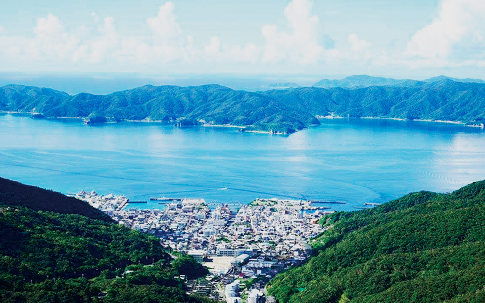
Amamigunto National Park is located in the southernmost area of Kagoshima Prefecture and was designated Japan’s 34th national park on March 7, 2017. Consisting of the Amami Oshima, Kakeroma, Ukejima, Yorojima, Kikaijima, Tokunoshima, Okinoerabujima, Yoron, and other islands, this national park retains a richly diverse natural environment, an ecosystem of endemic and endangered flora and fauna, and a cultural landscape born from relationships between humans and nature.
Protected Area Zoning System for Preserving the Natural World Heritage Site
Natural World Heritage sites require proper protection and control to maintain their value across future generations. For this reason, Natural World Heritage sites have established national parks, forest ecosystem reserves, natural monuments, and other protective measures based on national law and systems under the control of the nation. The Amami Oshima Natural World Heritage site is strictly protected, with the majority of it designated as a National Park Special Protection Zone or Class I Protection Zone. The buffer zone is mostly designated as a National Park Class II Special Zone and serves to protect the World Heritage site while encouraging harmony with residents.
The Unique Charms of the Amami Islands
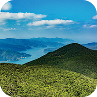
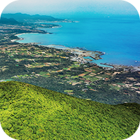
The Amami Islands are broadly categorized into “high islands” with mountainous terrain and “low islands” with low, flat terrain that stems mostly from differences in geological history. The high islands, which include Amami-Oshima (including Kakeromajima, Ukejima, and Yorojima) and Tokunoshima, are mountainous areas consisting primarily of Mesozoic lithic slate and sandstone, while the low islands, which include Kikaijima, Okinoerabujima, and Yorojima, are low-lying islands comprised of Ryukyu limestone formed by the uplift of coral reefs during the Cenozoic Quaternary. These differences in island formation have given rise to differing landscapes of ria coasts, terraces, and karst topography such as limestone caves as well as different ecosystems and differences in water environment and land usage that gives each island a unique charm.
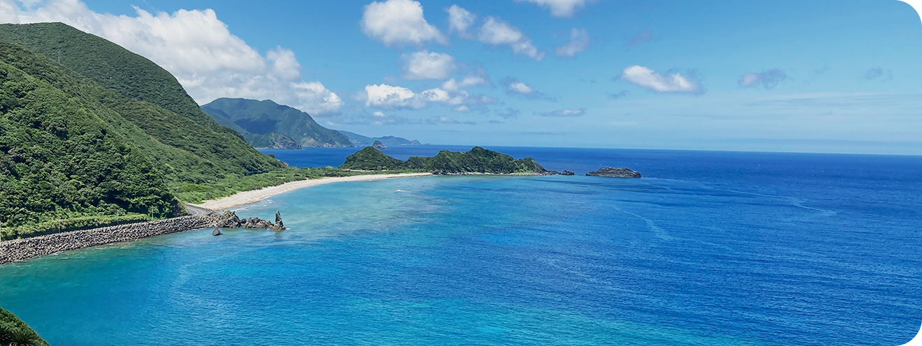
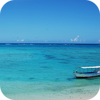
The Glittering Blue Seas of the Amami Islands
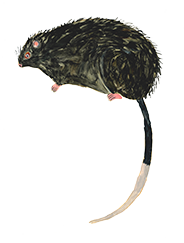
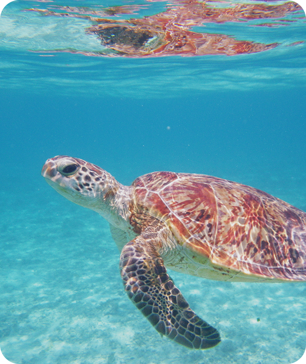
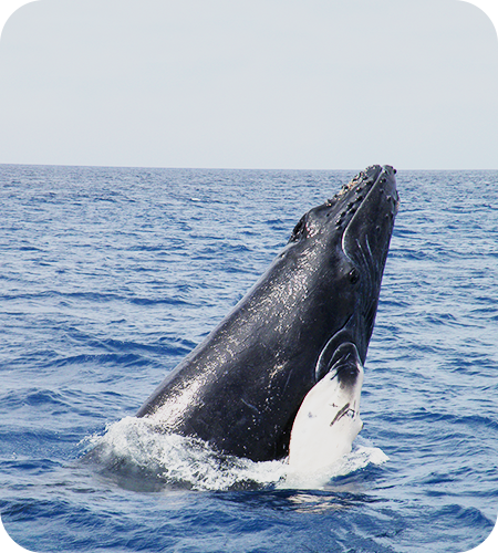
“The allure of the Amami Islands goes beyond the subtropical rainforests of Amami Oshima and Tokunoshima, which have gained recognition as a Natural World Heritage site. The seas around the Amami Islands have evolved coral reefs rich in biodiversity with over 220 confirmed species of reef-building coral. For coral reefs of a certain scale and level of biodiversity, the coral reefs of Amami Oshima are the farthest north in the world. The coastal areas serve as spawning grounds for sea turtles and collective breeding grounds for seabirds such as terns and petrels, an important stopover and breeding ground for animals that migrate vast distances. Humpback whales visit the seas around the Amami Islands to breed every year from winter to spring, making this a whale-watching spot.”
Amami Islands
Introduction to Amami Islands
The four areas, including Amami Oshima Island, have a unique biota due to the island’s origins as an isolated island separated from the Eurasian continent by tectonic movements and a history of diverse dispersions brought about by past climate changes, the Kuroshio Current and migratory birds. In addition, it is located biogeographically between the Palearctic realm and Indomalayan realm, which is an ecotone for biological distribution. Furthermore it has an average annual rainfall of about 3,000mm, which is rare for a region located near the 28th parallel north, making the region a well developed subtropical rainforest. These geographical factors influence each other in a complex manner, creating biological diversity that is still maintained to this day.
Amami-Oshima Island
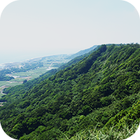
Amami-Oshima is the largest island in the Amami Islands and has a distinct culture influenced by both mainland Japan and Okinawa. In the north, you’ll find vast flatlands covered in farmland, where sugarcane cultivation thrives. The southern part of the island, meanwhile, is mountainous and home to a diverse range of unique wildlife. One of the most remarkable aspects of Amami-Oshima is its rich cultural heritage, which includes traditional island songs, brown sugar shochu, Oshima Tsumugi textiles, and more.
KAKEROMAJIMA
Kakerojima Island has an area of 77.39 square kilometers and is located across the Oshima Strait from the southern coast of Amami-Oshima. In terms of geology, the island is long and possesses a complex coastline totaling 147.5 kilometers in length. There are about 30 small settlements on the island.
UKEJIMA
Ukejima Island has an area of 13.34 square kilometers and is located south of Kakeromajima Island. The island has two settlements, Ukeamuro and Ikedi, and has seen an increase in tourism from visitors coming to fish and dive.
YOROJIMA
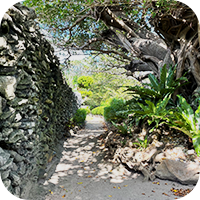
Yorojima Island, located to the south of Kakeromajima Island, covers an area of 9.35 square kilometers. The houses on the island are characterized by their distinctive coral stone exterior walls.
KIKAIJIMA
Kikaijima is an island with an area of 56.93 square kilometers. Most of the island is made of limestone that originates from coral, and the highest point rises about 200 meters above sea level. As the northern limit for the large butterfly species Idea leuconoe, the island is a well-known overwintering spot for Ideopsis similis and also serves as a stopover for the migrating butterfly species Parantica sita heading south from Honshu toward Taiwan.
TOKUNOSHIMA
With an area of 247.77 square kilometers, Tokunoshima is covered by forests inhabited by many rare plants and animals. In the center of the island lies a mountain range centered around Mt. Inogawadake (645m), while in the north there is a mountain range centered around Mt. Amagidake (533m). The areas surrounding the mountain ranges are flat, creating the largest agricultural land area in the Amami Islands. The island is also known for sumo and bullfighting.The long-standing tradition of bullfighting, an event deeply cherished by the people of the island, creates island-wide excitement.
OKINOERABUJIMA
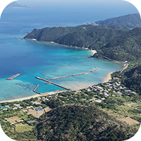
Okinoerabujima is an island with an area of 93.65 square kilometers, featuring a variety of karst topography and 200 to 300 underground stalactite caves. Predominantly flat, the island’s highest peak, Mt. Oyama, rises 245 meters above sea level in the southwest. Known for its flower production, the island is the top producer of lilies in Japan. As the place where historical figure Takamori Saigo was exiled during the late Edo period, this island is home to shrines and restored prison cells.
YORONJIMA
Yoronjima is a coral reef island with an area of 20.8 square kilometers located at the southernmost tip of the Amami Islands. Culturally influenced by Okinawa, the island is so close to Okinawa Prefecture that Cape Hedo, the northernmost tip of Okinawa Island, is visible to the south. In 1983, it established itself as a tourist destination under the name Panauru. The island shares a striking resemblance to the landscapes of Mykonos in Greece, so much so that they have become sister cities.
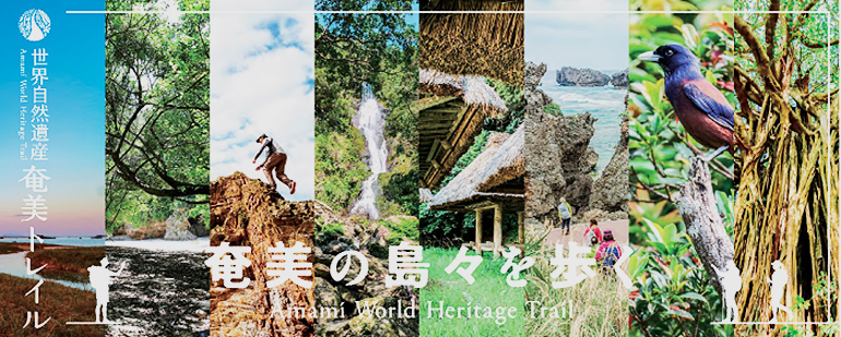
trail
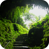
Amami World Heritage Trail
The Amami World Heritage Trail is a long-distance nature trail connecting the eight inhabited islands of the Amami Islands, an archipelago between the islands of Kyushu and Okinawa.For each of these eight unique islands, trails that let you experience the nature of Amami and the culture fostered here have been selected together with locals.